
Garmin Montana® 710, Rugged GPS Handheld Navigator with Large 5-inch Glove-Friendly Touchscreen, Satellite Imagery and Maps for Routing on Roads and Trails
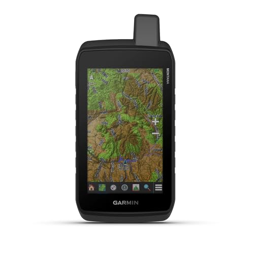
5” glove-friendly touchscreen handheld GPS navigator with easy-to-view color display; available with versatile mounting options (sold separately), depending on your activity
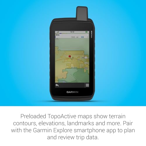
Navigate your adventures with included TopoActive maps and the ability to download additional maps, such as City Navigator maps for streets and BlueChart g3 charts for water (sold separately)
Rugged construction is rated to MIL-STD 810 for thermal, shock and vibration and IPX7 for water-resistance
$649.99
Stay on track with the rugged Montana® 710 handheld GPS navigator. Built to guide you through all kinds of adventures, it includes TopoActive mapping and a glove-friendly 5” color touchscreen. Expanded 32 GB memory capacity lets you store more maps to keep your expeditions on course. High-resolution satellite imagery, available via subscription-free, direct-to-device downloads (requires a connection with Wi-Fi® technology), shows a clear overhead view of your route and surrounding terrain. Get the on- or off-road capabilities you need with multi-GNSS satellite network support and ABC sensors. Add ongoing access to Outdoor Maps+ (sold separately) for a wide variety of premium mapping content. Explore longer with up to 24 hours of battery life in GPS mode and up to 432 hours in ultralow-powered expedition mode, and recharge easily with a standard USB-C® cable. Plus, Montana 710 meets MIL-STD 810 for thermal, shock and vibration and is rated IPX7 for water-resistance.
5” glove-friendly touchscreen handheld GPS navigator with easy-to-view color display; available with versatile mounting options (sold separately), depending on your activity
Navigate your adventures with included TopoActive maps and the ability to download additional maps, such as City Navigator maps for streets and BlueChart g3 charts for water (sold separately)
Rugged construction is rated to MIL-STD 810 for thermal, shock and vibration and IPX7 for water-resistance
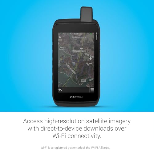
Downloadable high-resolution satellite imagery shows photorealistic overhead views and lets you create waypoints based on landmarks
Expanded 32 GB memory capacity lets you store additional maps and more to keep your expeditions on course; with a subscription to Outdoor Maps+ (sold separately), get ongoing access to a wide variety of premium mapping content, which you can download to your navigator via Wi-Fi technology
Compatible with the Garmin Explore smartphone app to plan and review trip data; also manage your waypoints, courses and activities
Rechargeable lithium-ion battery pack can provide up to 24 hours of battery life in GPS mode and up to 432 hours in expedition mode between charges; can also be powered with traditional AA batteries (not included)
Recharge easily with a standard USB-C cable
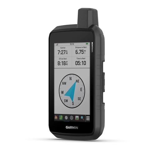
Built-in ABC sensors help you navigate your next trail, including an altimeter for elevation data, barometer to monitor weather and 3-axis electronic compass
Access up-to-date active weather forecasts via the Garmin Connect app on your compatible smartphone
User Reviews
Be the first to review “Garmin Montana® 710, Rugged GPS Handheld Navigator with Large 5-inch Glove-Friendly Touchscreen, Satellite Imagery and Maps for Routing on Roads and Trails”
You must be logged in to post a review.
There are no reviews yet.